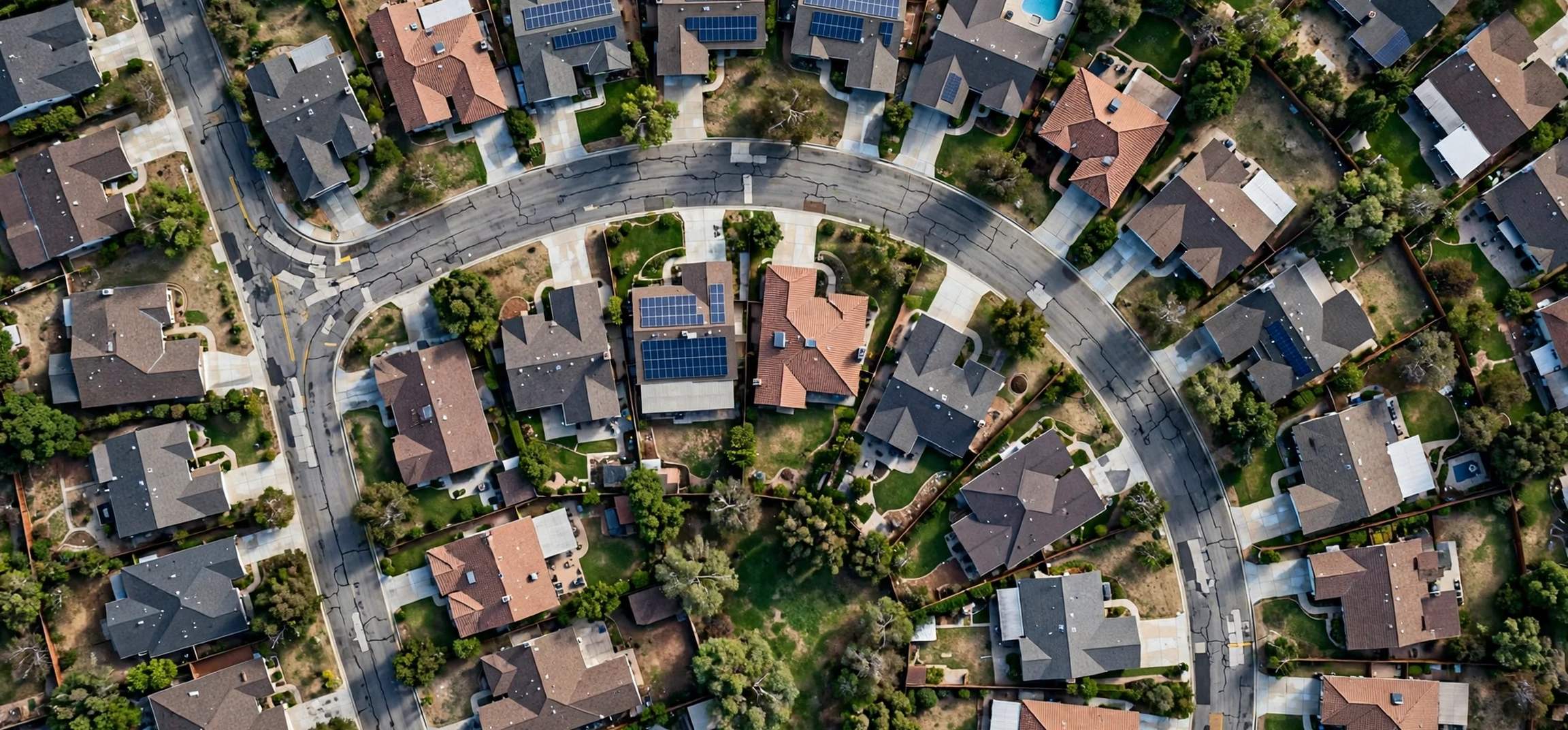
A satellite view of homes lets you see your own house from above, without leaving your chair. A satellite view of homes shows roofs, gardens, driveways, nearby roads, and the shape of your plot, all captured by satellites or aircraft and stitched into an online map. Many people use it to check a new home before a viewing, plan a garden project, measure a roof, or simply satisfy curiosity about how their street looks from the sky. This guide explains how to use a satellite view of homes for your own property, what the images can and cannot show, and how to protect your privacy while you explore.
The most important rule comes first. Use a satellite view of homes only for your own home, or for a property you have a legitimate reason to view, such as a home you are buying, renting, or managing. Do not use satellite imagery to track, monitor, or investigate another person, their movements, or their private property. Satellite images are not live video, and they should never be used as a tool for surveillance. This guide focuses entirely on own-home uses, such as planning, maintenance, and understanding your own plot, together with clear privacy advice for everyone.
Satellite View of Homes: How It Works
A satellite view of homes is built from overhead imagery collected over time. Some imagery comes from satellites orbiting far above Earth, while much of the detailed imagery in towns and cities comes from aircraft flying planned routes. Mapping services combine these images, align them with street maps, and present them as a seamless layer you can zoom, pan, and tilt. When you switch a map to satellite mode, you are not seeing a live feed. You are seeing the most recent available image for that area, which may be months or even years old.
That time lag matters. A satellite view of homes may show a garden before a recent extension, a roof before a repair, or a tree that has since been removed. Always check the image date if your mapping service displays one, usually in a corner of the screen. If no date is shown, treat details as a starting point, not as current proof. For planning decisions, confirm what you see with a recent site visit, a photograph, or a professional survey. Satellite imagery is excellent for orientation and rough measurement, but it does not replace an on-the-ground check.
Resolution and what you can actually see
Resolution determines how much detail you can see. In most cities, you can clearly make out roof shapes, chimneys, garden paths, driveways, parked cars, and large trees. In rural areas, resolution may be lower, and small features may blur. You will not be able to read small text, see through roofs, or identify people in any meaningful way from standard public satellite imagery. Faces and number plates are normally blurred by mapping providers. If an image looks unusually sharp, it is likely aerial photography rather than satellite imagery, but the same privacy principles still apply.
Satellite View of Homes for Your Own Property
Using a satellite view of homes for your own property is straightforward and useful. Start by opening your preferred mapping service and switching to satellite or aerial view. Search for your own address, or drop a pin on your home manually. Zoom in slowly until your roof and garden fill the screen. Take a moment to orient yourself: find the road in front of your home, the neighbouring plots, and any landmarks such as a park or junction. Orientation prevents the common mistake of studying the wrong house, especially on streets where roofs look similar.
Once you have found your home, a satellite view of homes can help with several practical tasks. You can check the shape and condition of your roof from above, spot missing tiles or moss build-up, and see whether gutters look clear. You can plan a garden layout, measure a lawn or patio area roughly, and decide where a shed, greenhouse, or new fence might fit. You can also check access for deliveries or building work, such as whether a large vehicle can reach your driveway. For each task, use the imagery as a planning aid, then verify measurements on the ground before ordering materials or booking work.
Homebuyers also benefit. Before a viewing, a satellite view of homes can show the size of the garden, the distance to a main road, nearby green space, and whether the property backs onto a railway line, a school, or commercial buildings. It can reveal parking arrangements and the layout of the surrounding streets. Combine this overhead view with street-level imagery and an in-person visit. Together, they give a much fuller picture than any single view alone, and they help you ask better questions during a viewing.
Satellite View of Homes: Step-by-Step for Your Own Home
Follow these steps for a safe, useful check of your own home. First, open a reputable mapping service on a phone or computer and enable satellite view. Second, search using your own address or navigate manually to your street. Third, confirm you have the right property by matching the roof shape, driveway position, and neighbouring houses with what you know. Fourth, use the measuring tool, if available, to estimate distances or areas, remembering that these are approximate. Fifth, save or screenshot the view for your own planning notes if you wish, but do not share images of other homes publicly.
Next, explore different views. Many services offer a tilted or three-dimensional view, which can help you understand roof height and garden levels. Street-level imagery, where available, complements the overhead view by showing frontages, fences, and access points. Historical imagery, offered by some tools, lets you compare your home over time, which is useful for seeing how trees have grown or how a neighbourhood has changed. If historical images are available, use them for your own property history, such as documenting an extension or a garden redesign, rather than for checking on neighbours.
| Own-home task | What satellite view shows | Limit to remember |
|---|---|---|
| Roof check | Roof shape, tiles, chimneys | Image may be old; inspect in person |
| Garden planning | Lawn, paths, trees, boundaries | Measurements are approximate only |
| Access planning | Driveway, road, parking | Check width and height on site |
| Buying research | Plot size, surroundings, green space | Visit in person before deciding |
| Boundary sense | General plot outline | Not a legal boundary record |
| Project notes | Before-and-after comparison | Confirm dates on each image |
The table above summarises sensible own-home uses and their limits. The boundary row deserves emphasis. A satellite view of homes does not prove a legal boundary. Fences, hedges, and walls visible from above may not sit exactly on the legal line, and only title plans, deeds, and a professional survey can settle a boundary question. Use satellite imagery to start a conversation with a surveyor, not to settle a dispute with a neighbour.
Satellite View of Homes and Privacy: What to Know
Privacy is a genuine concern with a satellite view of homes, and it deserves a clear explanation. Public satellite imagery is collected at a scale that shows properties, not people. Mapping providers blur faces and number plates, and they offer processes to request additional blurring of a home or a person in street-level imagery. Satellite imagery itself is usually too coarse to identify individuals, but it can still feel intrusive to see your home from above. Understanding what is shown, and what controls exist, helps you make informed choices about your own property.
If you would prefer your home to be less visible, check your mapping provider’s privacy options. Many providers allow you to request blurring of your house in street-level views. For satellite views, options are more limited, because the imagery covers whole areas rather than single homes, but you can still ask the provider about its policy. You can also reduce exposure in other ways: avoid posting satellite screenshots of your home on public social media, avoid sharing your exact address alongside aerial images, and review what estate listings or planning documents already show publicly. These steps protect your privacy without affecting legitimate own-home planning.
Equally important is respecting other people’s privacy. Do not zoom into a neighbour’s garden to check what they are doing, do not screenshot another person’s home and share it, and do not use satellite imagery to follow someone’s movements or routines. If you are concerned about a neighbour’s property for a legitimate reason, such as a safety issue, contact the relevant authority rather than conducting your own aerial investigation. A satellite view of homes is a planning and orientation tool, not a surveillance tool, and using it that way crosses a clear ethical line.
Children, safety, and sharing
Be especially careful when children are involved. Do not share satellite images that reveal a school route, a playground, or a child’s home in a public post. Even a seemingly harmless screenshot can reveal location details when combined with other information online. Keep own-home images in private planning folders, and crop out neighbouring properties when you share a garden plan with a contractor. A contractor only needs your plot, not the whole street.
Common Mistakes With a Satellite View of Homes
Several mistakes are common when people first use a satellite view of homes. The first is treating an old image as current. Always check the date and confirm changes on the ground. The second is trusting measurements too precisely. Online measuring tools are helpful for rough estimates, but they can be off by a metre or more, especially on sloped ground. The third is misidentifying a property, particularly in terraced streets or apartment blocks where roofs look alike. Match several features, not just one, before you assume you have the right home.
Another mistake is assuming that satellite imagery shows ownership. It shows physical features, not legal rights. A driveway that looks shared may be privately owned, and a garden that looks open may be divided by a legal boundary that is invisible from above. Finally, avoid relying on satellite imagery for safety-critical decisions, such as whether a roof is safe to walk on or whether a tree is dangerous. Those judgments need a professional inspection. Satellite imagery informs, but it does not diagnose.
For related property and address research on this site, see a property search by address guide, finding homeowner insurance by address, and address from latitude and longitude. Use these only for properties you own or have a legitimate reason to research, and follow the same privacy principles described above.
Frequently Asked Questions About Satellite View of Homes
Is a satellite view of homes live?
No. A satellite view of homes shows previously captured imagery, not a live feed. The image may be months or years old, so always check the date shown by your mapping service and confirm current conditions in person.
Can I see my own house on a satellite view?
In most towns and cities, yes. Search for your own address in satellite mode, or navigate to your street manually, and zoom in until your roof and garden are clear. Rural homes may appear at lower resolution, but the general plot and surroundings should still be visible.
Can satellite view show inside my house?
No. Public satellite imagery shows roofs and outdoor areas only. It cannot see through roofs or walls, and faces and number plates are normally blurred. If you have privacy concerns, check your provider’s blurring request options.
Is it legal to look at my own home from above?
Viewing publicly available satellite imagery of your own home for planning or personal use is a normal, lawful activity in most places. Using imagery to harass, stalk, or monitor another person is not acceptable, regardless of the tool used. When in doubt, stick to your own property and legitimate planning purposes.
Conclusion
A satellite view of homes is a powerful planning tool when used responsibly for your own property. It helps you understand your roof, garden, access, and surroundings, plan projects, and research a home before a viewing. Remember that images are not live, measurements are approximate, and overhead views do not prove legal boundaries. Above all, respect privacy: use satellite imagery for your own home, keep screenshots private, and never use it to track or monitor anyone else. Used that way, it is a practical, safe, and genuinely useful view of home.